
Mulberry River Road Scenic Byway
On Sunday afternoon we set out for an adventure along the Mulberry River Road Scenic Byway. While it’s still technically winter we’re beginning to see hints of spring including warmer temps and sunshine that afternoon. It was a lovely day for a drive.
Pig Trail Scenic Byway
We had a good bit of rain earlier in the week so as we turned off the Interstate onto the Pig Trail Scenic Byway we enjoyed seeing mini waterfalls tumbling down the rocks along the road.
A little further on we turned onto the Mulberry River Road Scenic Byway.
Mulberry River Road Scenic Byway


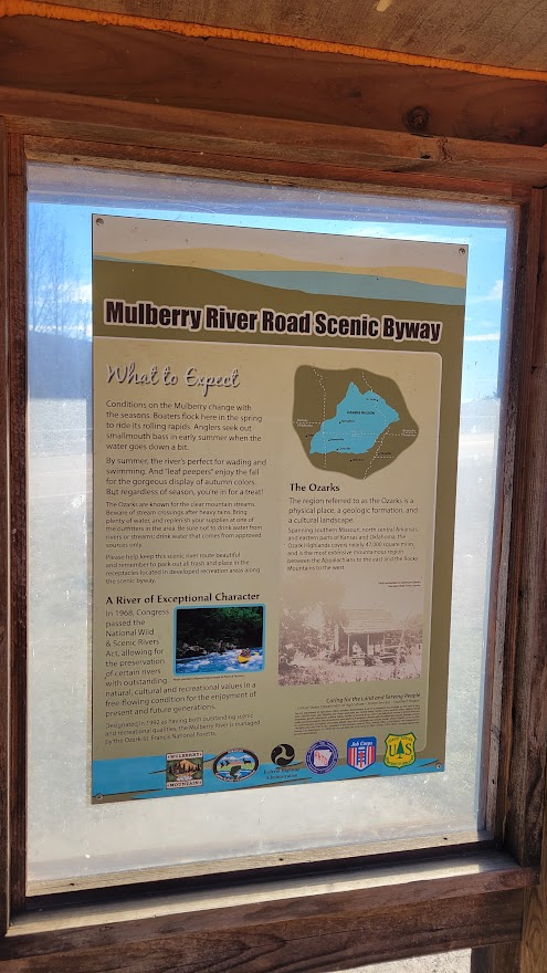
Naturally we had to stop at the pull-outs and read the historical markers as we came to them.
We learned that the native stone guard rails along the highway were built by the Civilian Conservation Corps during the Great Depression. I think that adds to the beauty of the highway.
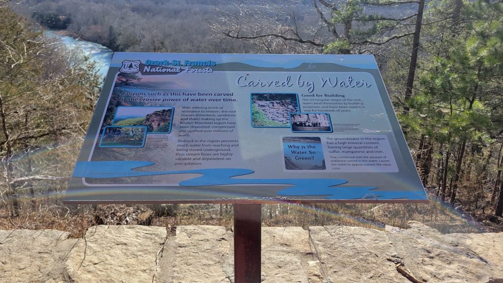
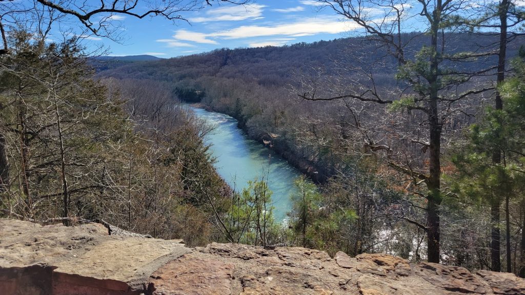
While we admired the “aqua color” of the water we thought it was a stretch to describe it as “jewel-like.” A murky jewel, maybe. Perhaps the murkiness is due to the recent rain, but I don’t think so. I think it’s just a regional difference and we’re still used to the crystal-clear waters in the northwest that reflect the blue of the sky. Now, that is jewel-like.
Finding the Falls
Our destination was High Bank Twin Falls. I hadn’t realized we’d need to hike to get there. “Only two-tenths of a mile from the road,” Lyle assured me. “Nothing too strenuous.”
“From what I read, the trail isn’t marked very well,” he said. No kiddin’!
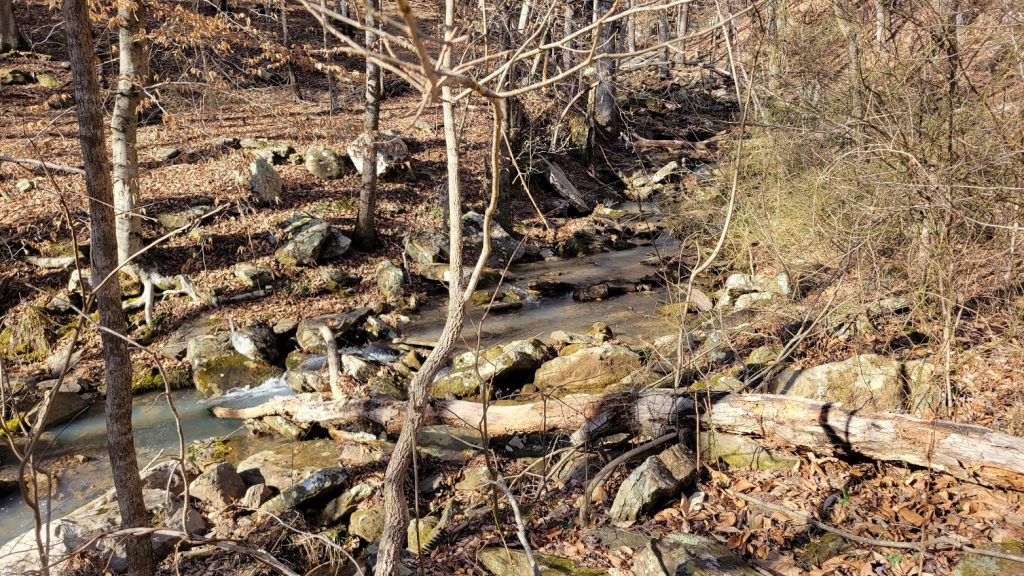
But with it being winter the undergrowth wasn’t too bad so we started out following the creek…
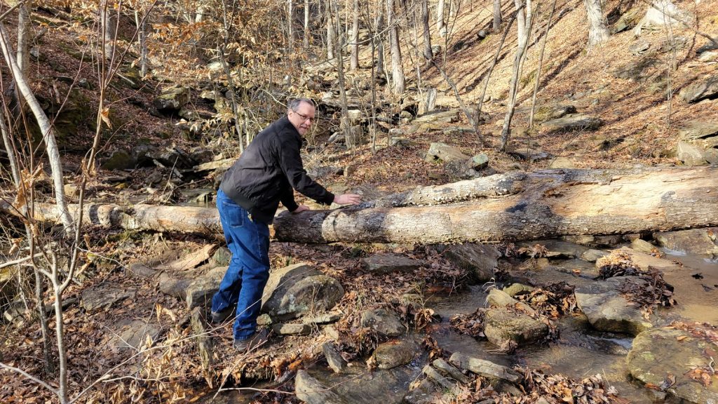
…jumping from rock to rock, climbing over fallen logs. After a bit we came to a “Y” in the creek.

Water tumbled down the hillside in one direction. Pretty as that was I had my doubts about that being the waterfall we were looking for.

The other direction looked like a dry creek bed full of large rocks. That didn’t seem very promising either. We weren’t sure which way to go, but I was not inclined to shinny up the hillside so we continued along the “dry” creek.
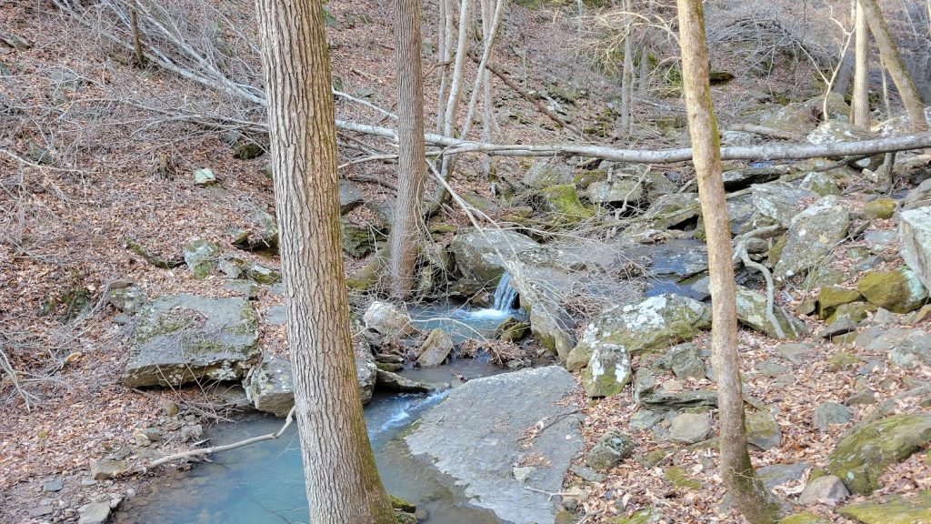
Before long water reappeared in the creek. Apparently it was flowing under the large rocks in that one section that looked dry. “I can hear a waterfall ahead,” I told Lyle.
“Can you?” he asked. His hearing is not as good as mine.
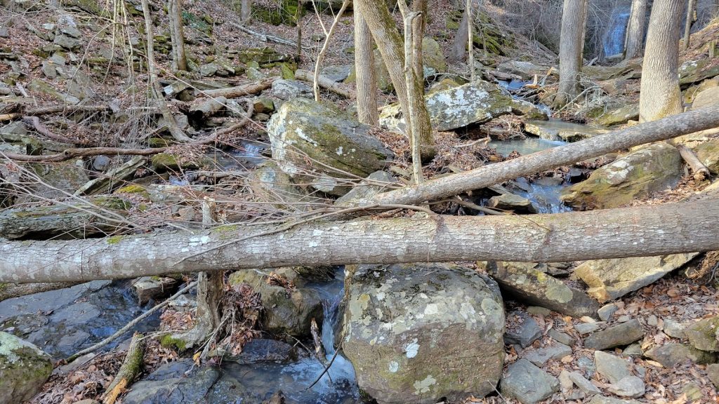
Soon enough, “I can see it!” he told me. And so we scrambled onward.
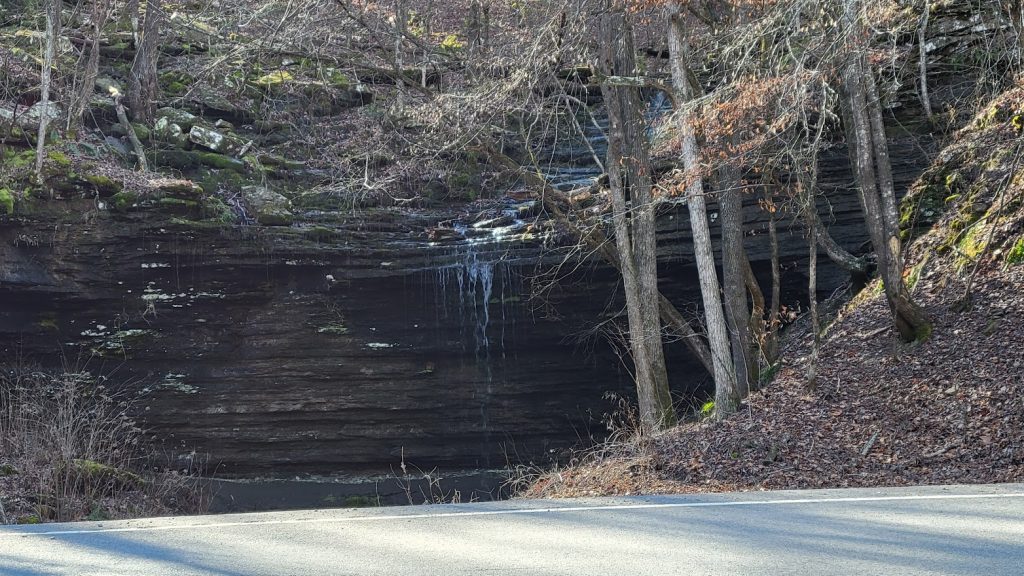
High Bank Twin Falls
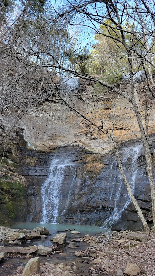
Nice!
Notice how the water tumbles over the bank all the way at the top then hits the rocks about halfway down to continue splashing down to the “jewel-like” pool at the bottom.
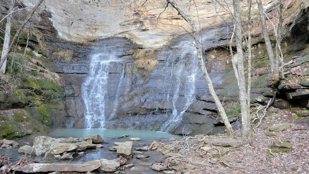
We declared it was worth the hike. After admiring it for a few minutes and taking several pictures we turned to wend our way back to the car.

When we reached the Y Lyle decided he wanted to explore the other “uphill” branch of the creek. If I had had better shoes and a walking stick I might have joined him.

Instead I waited at the bottom and watched.

When he got back he told me he only went about half-way up. There were two more levels of smaller waterfalls above him.
He had read that these are seasonal falls and it’s best to go after a heavy rain. So if you go looking for them be mindful of that, otherwise they might not be there.
Homeward Bound
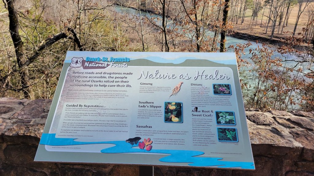
Back on the highway we continued to enjoy the scenery and stop for historical markers. I was especially interested in this one about native medicinal herbs. I’ve been studying herbalism and learning about healing plants that grow locally.
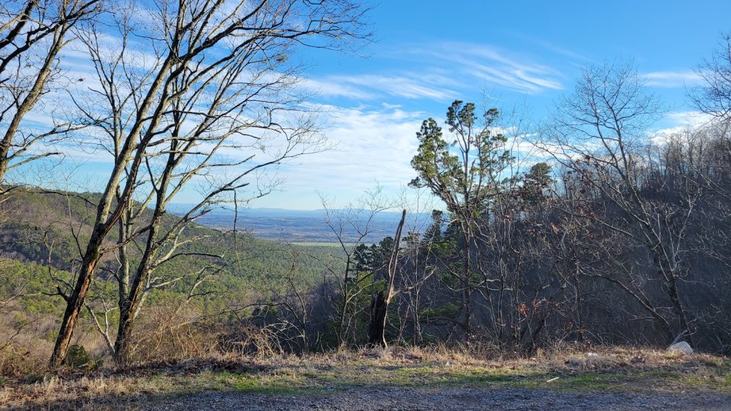
One more scenic pull-out overlooking the winter forests before turning towards home.
Other Adventures We’ve Had in Arkansas

